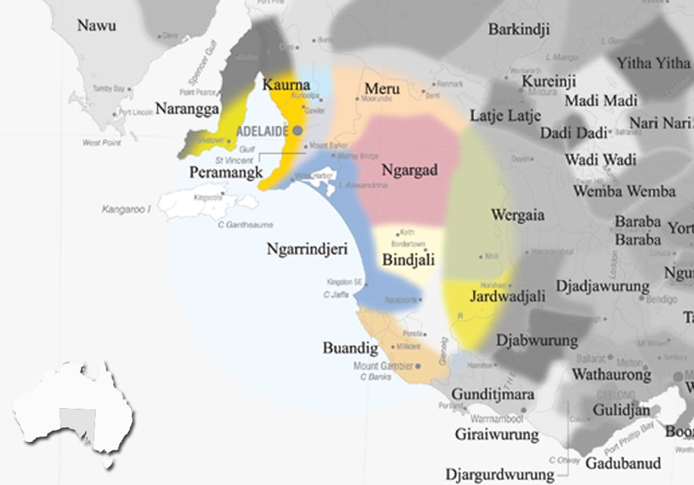
Tanganekald or Thangal is one of the many dialects of the Ngarrindjeri language of the Ngarrindjeri nation. Ngarrindjeri land lies on the lower reaches of the Murray River, Lakes and Coorong region.
Tanganekald is the southern most group, and its country lies along the long stretch of the Coorong, and runs as far south as the township of Kingston SE.
Geographical locations that are often associated to this group include: the Coorong region; towns such as Kingston SE and Meningie; Salt Creek; Ten Miles Point (Taratap) etc.
Learn some Tanganekald language on our Online Language Learning Portal.
AIATSIS id : S.11
VARIATIONS
Danganalun, Danganegald, Dangani, Milmain-jeri, Milmendura, Milmenrura people, Polenjunga, Taloinjunga, Tanganekald (= Tangane + -kald ‘language’), Tangane, Tangani, Tangalun, Tanganalun, Tanganarin, Tenggi (Potaruwutj term, actually for Coorong itself), Tenkinyra, Thunga, Thungah, Tunga, Wattatonga (name used by the Bunganditj, literally ‘men of the evening’ because they live to the west).
DISCLAIMER:
The above map is based upon the Horton Indigenous Map of Australia © Aboriginal Studies Press, AIATSIS, and Auslig/Sinclair, Knight, Merz, 1996. The full map is available on the AIATSIS website. The locations of the languages of SA, as stated on the this website are not intended for Land Claim use, and are an approximate guide only. Individual language project locations are based on information from publicly available MILR (ILS) documents.