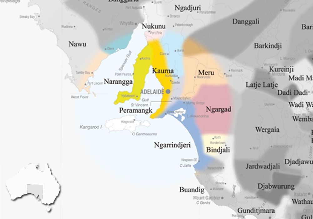
Peramangk is a language of the Mount Lofty region. There are no known speakers of Peramangk, but research is currently being undertaken by the MLT and community partners into 19th century written sources. Colonial records and the writings of Norman Tindale of the South Australian Museum suggest that traditional Peramangk country lay to the east of Kaurna country and west of lands of Ngarrindjeri and River Murray peoples. It has been suggested that Peramangk lies on the boundary between two different major language groups: the Yura group (including for example Kaurna) and the Ngarrinyeric group (including for example Tanganekald, Ramindjeri and Yeraldi).
AIATSIS id : S.05
VARIATIONS
Beramangg, Baramangga (used by AIATSIS), Marimejuna (‘mari’ = east ‘meju’ /’meyu’ = ‘man’, a Kaurna term), Meraldi, Mereldi (a Ramindjeri term), Merildakald (a Tanganekald term applied also to the Kaurna), Mount Barker tribe, Ngurlinjeri (Jaril-dekald name from ‘ngurle’ = hill and ‘-njeri’ = belonging to), Peramang-k, Peramangk, Peramarma (a Tanganekald term based on their name ‘Pe:ra’ for the Tiers Range at Mount Barker), Tarrawatta (name of northern group near Angaston), Wangarainbula (‘wangara’ = hill; a Ngaiawang term), Waugarainbula.
DISCLAIMER:
The above map is based upon the Horton Indigenous Map of Australia © Aboriginal Studies Press, AIATSIS, and Auslig/Sinclair, Knight, Merz, 1996. The full map is available on the AIATSIS website. The locations of the languages of SA, as stated on the this website are not intended for Land Claim use, and are an approximate guide only. Individual language project locations are based on information from publicly available MILR (ILS) documents.