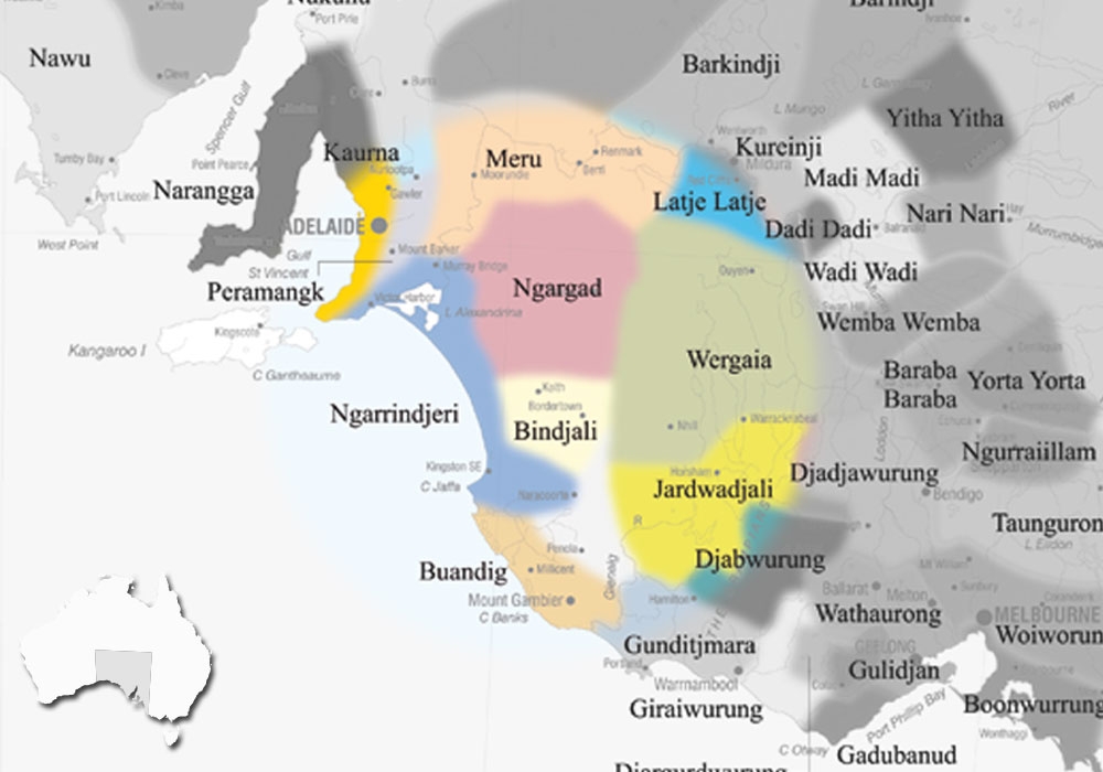
Ngarkat lies east of the Murray River in South Australia and stretches across to the Victorian border, including the towns of Karoonda and Lameroo, and the Ngarkat Conservation Park.
It lies east of the Ngangaruku language, and south of the closely related Murray River languages / dialects of Ngawadj, Yirawirung and Ngintait (from across the Victorian border).
AIATSIS id : S.09
VARIATIONS
Arkatko, Baine Hill tribe (group around Lameroo), Baripung (‘barip’ = man), Beeripung, Beripar, Booripung, Boraipar (language name), Boripar, Buripung, Deenbauraket, Doenbauraket, Doen-baurarket, Duwinbarap (eastern term ‘barap’ = man), Duwinbaray, Jackalbarap, Jacke-gilbrab, Jakalbarap, Jakel-baluk (Wotjobaluk term), Mangkarupi (Jarildekalde / Yarali term), Merkani (Jaralde and Tangane term, means ‘enemy’), Merkanie, Ngalundji (a name for language), Nalunghee, Ngardad, Ngargad, Ngarkat (used by AIATSIS), Ngarkato, Ngerget, Ngeruketi (Maraura term), Ratarapa (Nganguruku term), Tatiari (regional name for mallee desert), Thatiari (general term used by Tanganekald, sometimes included the Potaruwutj), Tjakulprap (southeastern term ‘parap / barab = man), Wragarite, Wularuki (name for south western group).
DISCLAIMER:
The above map is based upon the Horton Indigenous Map of Australia © Aboriginal Studies Press, AIATSIS, and Auslig/Sinclair, Knight, Merz, 1996. The full map is available on the AIATSIS website. The locations of the languages of SA, as stated on the this website are not intended for Land Claim use, and are an approximate guide only. Individual language project locations are based on information from publicly available MILR (ILS) documents.